Property Record
Whittaker Rd, Ypsilanti, MI 48197
NEARBY LISTINGS FOR SALE OR LEASE
-
-
View all Ypsilanti listings for sale on LoopNet.com
Property Detail
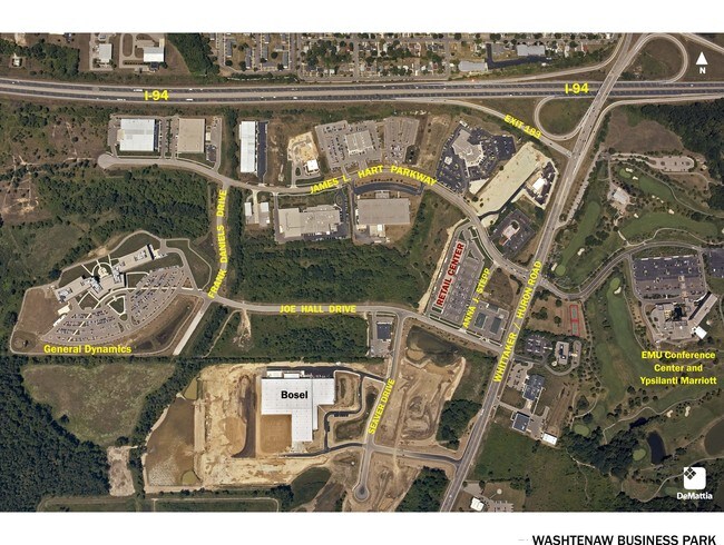
Whittaker Rd
20-16-400-026
YP-21-13A-1A-1B: COM AT A SE 1/4 SEC 21, TH S 79-44-20 W 2380.98 FT ALG C/L OF TEXTILE RD; TH ALONG THE C/L OF WHITTAKER RD N
Residentialacreage
Washtenaw
X
Michigan
26161C0440E
0.52 AC
0
Washtenaw E of 23
2025
Detroit
410600
Ann Arbor, MI
DEMOGRAPHICS near Whittaker Rd
1 Mile
3 Mile
5 Mile
2024 Total Population
4,754
46,694
114,711
2029 Population
4,657
46,125
113,346
Pop Growth 2024-2029
(2.04%)
(1.22%)
(1.19%)
Average Age
39
38
38
2024 Total Households
1,699
19,112
47,475
HH Growth 2024-2029
(2.06%)
(1.31%)
(1.37%)
Median Household Inc
$120,103
$62,403
$59,896
Avg Household Size
2.70
2.40
2.30
2024 Avg HH Vehicles
2.00
2.00
2.00
Median Home Value
$257,634
$203,573
$212,982
Median Year Built
1991
1975
1976
Nearby Places
Map Layers
Map Styles
 Street
 Aerial
- Restaurants
- Banks
- Shops
- Fitness
- Groceries
PUBLIC TRANSPORTATION
AIRPORT
Detroit Metro Wayne County
DRIVE
WALK
Distance
Detroit Metro Wayne County
31 min
21.3 mi
Freight Ports
Port of Toledo
DRIVE
WALK
Distance
Port of Toledo
70 min
50.9 mi
Nearby Properties
Address
Land Use
TOTAL SIZE
Lot Size
Zoning
Address
Land Use
TOTAL SIZE
Lot Size
Zoning
528 SF
49 AC
BLANK
Address
Land Use
TOTAL SIZE
Lot Size
Zoning
231.77 AC
BLANK
Address
Land Use
TOTAL SIZE
Lot Size
Zoning
11,894 SF
110 AC
BLANK
Address
Land Use
TOTAL SIZE
Lot Size
Zoning
174.46 AC
BLANK
Address
Land Use
TOTAL SIZE
Lot Size
Zoning
8,800 SF
30.66 AC
BLANK
Address
Land Use
TOTAL SIZE
Lot Size
Zoning
1,904 SF
69 AC
BLANK
Address
Land Use
TOTAL SIZE
Lot Size
Zoning
77.04 AC
BLANK
Address
Land Use
TOTAL SIZE
Lot Size
Zoning
17.95 AC
BLANK
Address
Land Use
TOTAL SIZE
Lot Size
Zoning
95.84 AC
BLANK
Address
Land Use
TOTAL SIZE
Lot Size
Zoning
118.25 AC
BLANK
Address
Land Use
TOTAL SIZE
Lot Size
Zoning
95.82 AC
BLANK
Address
Land Use
TOTAL SIZE
Lot Size
Zoning
114.69 AC
BLANK
Address
Land Use
TOTAL SIZE
Lot Size
Zoning
102.99 AC
BLANK
Address
Land Use
TOTAL SIZE
Lot Size
Zoning
Address
Land Use
TOTAL SIZE
Lot Size
Zoning
7,468 SF
13.33 AC
BLANK
Address
Land Use
TOTAL SIZE
Lot Size
Zoning
3,116 SF
1 AC
BLANK
Address
Land Use
TOTAL SIZE
Lot Size
Zoning
11.15 AC
BLANK
Address
Land Use
TOTAL SIZE
Lot Size
Zoning
7,408 SF
2 AC
BLANK
Address
Land Use
TOTAL SIZE
Lot Size
Zoning
2,169 SF
2.73 AC
BLANK
Address
Land Use
TOTAL SIZE
Lot Size
Zoning
Address
Land Use
TOTAL SIZE
Lot Size
Zoning
80.57 AC
BLANK
Address
Land Use
TOTAL SIZE
Lot Size
Zoning
2,097 SF
0.60 AC
BLANK
Address
Land Use
TOTAL SIZE
Lot Size
Zoning
104.25 AC
BLANK
Address
Land Use
TOTAL SIZE
Lot Size
Zoning
1,436 SF
80 AC
BLANK
Address
Land Use
TOTAL SIZE
Lot Size
Zoning
89.41 AC
BLANK
Address
Land Use
TOTAL SIZE
Lot Size
Zoning
0.60 AC
BLANK
Address
Land Use
TOTAL SIZE
Lot Size
Zoning
0.60 AC
BLANK
Address
Land Use
TOTAL SIZE
Lot Size
Zoning
2,338 SF
1 AC
BLANK
Address
Land Use
TOTAL SIZE
Lot Size
Zoning
0.60 AC
BLANK
Address
Land Use
TOTAL SIZE
Lot Size
Zoning
2,328 SF
53 AC
BLANK
The World's #1 Commercial Real Estate Marketplace
Connect with us
© 2025 CoStar Group
The information above has been obtained from sources believed reliable. While we do not doubt its accuracy we have not verified it and make no guarantee, warranty or representation about it. It is your responsibility to independently confirm its accuracy and completeness. Any projections, opinions, assumptions, or estimates used are for example only and do not represent the current or future performance of the property. The value of this transaction to you depends on tax and other factors which should be evaluated by your tax, financial, and legal advisors. You and your advisors should conduct a careful, independent investigation of the property to determine to your satisfaction the suitability of the property for your needs.